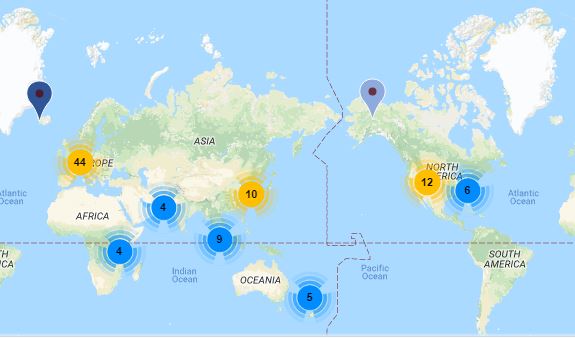
Consultant Roland Berger has produces a map of urban air mobility projects around the world. According to the company: “The Roland Berger Urban Air Mobility (UAM) map includes global autonomous (mid- to long term) urban air mobility projects focusing on the use cases (1) passenger transport, (2) delivery & e-commerce (cargo), (3) medical, emergency & security (excl. small piloted police drones), (4) other purposes like inspection and traffic control as well as (5) general UAM testing and research. Explicitly not included are projects focusing on military defense use cases, on agricultural use cases, on inspection use cases outside of urban areas and on leisure use cases. The flight area is mainly classified in (a) Intra-city & metropolitan area (incl. airport transport) with flight distances typically below 100 km and (b) Inter-city with connection of two or more cities with potential flight distances also above 100 km.”
“Of the 100 or so projects currently identified, almost half are being conducted in Europe, almost one third in Asia-Pacific and around one fifth in the United States. Three areas, namely online trade and delivery, medication/first aid transportation and general development, account for 25% each. Only around 15% of projects are concerned with passenger transportation. More than half of projects concern the flying distance within a single city or metropolitan area (incl. the local airport).”
For more information:
https://www.rolandberger.com/en/Point-of-View/Mapping-autonomous-urban-air-mobility’s-progress.html

