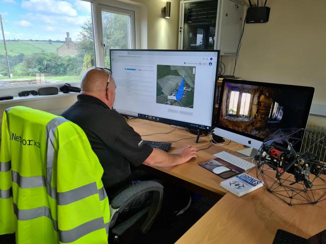
Networx3 Drones, based near Blackburn, Lancashire, has invested a six-figure sum to create the most accurate 3D maps in the UK by using drones, reports lancashiretelegraph.co.uk. Presently, the company operates a fleet of five drones for clients involved in the emergency services, water companies and energy suppliers.
The Great Harwood business aims to use their fleet to capture thousands of photographs during pre-programmed flights to create large, high detail photo maps that can be used to monitor a variety of landscapes and developments.
Networx3 Drones MD, Ian Ashworth, commented, “Using this emerging technology massively expands what we can do with our drone fleet. We have already had interest from the construction and insurance industry as the mapping capabilities offer a 3D view of any land, property or water.”
Apart from Networx3 Drones five qualified commercial unmanned craft operators, it has a UKP45,000 drone control vehicle which is home to its hi-tech craft, mapping software and a two-person operations hub.
The drones will use the world’s first adaptive flight planning app for commercial missions coupled with data analytics to capture the photos. These photographs and data will then be transformed into detailed and accurate photo maps using software from data analytics experts Next Labs.
Ashworth commented, “The level of detail on the maps we produce is phenomenal. You can see individual roof tiles on properties, rivets on a mobile phone mast, and points on a railway line.”
The company explained these high-detail and high-resolution maps will offer a distortion-free representation of an area that’s true to the geography on the ground and will be so accurate that they can be used to measure distances between points and capture real-world conditions.
Ashworth continued, “We can record, inspect and survey skyscrapers, bridges, reservoirs, landfill sites, quarries, solar farms, cladding, agricultural land and then produce a 100% accurate digital map for clients like they’ve never seen before.”
The company’s clients will be able to use these maps to plan new developments, analyse landscapes and survey buildings.
For visual presentation
https://www.youtube.com/watch?v=yhpxHWm3JSM
For more information
https://www.networx3drones.co.uk/
(News Source: https://www.lancashiretelegraph.co.uk)

